Light
Light
 Dark
Dark
 System
 Submit
 Community
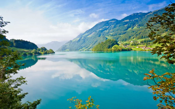
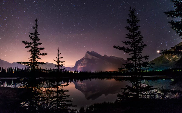
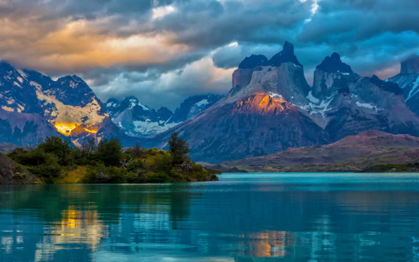
Cormorant Bay, Lake Wivenhoe Dam, Wivenhoe Pocket Queensland Australia by lonewolf6738 
(Premium Users Can Just Click The Image )

 Attribution
Created By:
lonewolf6738
 Free For Private, Personal Use
(for any other usage, please contact the artist)
Additional Info from lonewolf6738:
 License: CC BY-NC-ND
Photo taken with a Nikon D7100
Lake Wivenhoe is a lake formed by the Wivenhoe Dam and the surrounding locality in the Somerset Region, Queensland, Australia.
The locality includes the dam wall and associated water management infrastructure at the south, the lake created by the dam, sections of the Brisbane and Stanley Rivers as they flow into the lake from the north and a narrow strip of land around the dam, the lake and river the sections. The lake's boundaries are very irregular and this is reflected in the very irregular boundaries of the locality. The locality is entirely set aside for water management purposes.
Due to its unusual shape, Lake Wivenhoe has many adjacent localities including (commencing from the dam wall in the south and proceeding clockwise: Wivenhoe Pocket, Patrick Estate, Wivenhoe Hill, Coominya, Moombra, Glen Esk, Murrumba, Coal Creek, Caboonbah, Mount Beppo, Cressbrook, Lower Cressbrook, Cooeeimbardi, Somerset Dam, Crossdale, Bryden, Dundas, and Split Yard Creek.The Brisbane Valley Highway passes through the south of the locality as it travels across the top of the dam wall.
History : The name Wivenhoe comes from the name of the pastoral property established in 1864 by Edmund Blucher Uhr, which took its name from the town of Wivenhoe in Essex, England.
 Interact
 8 Like
 4 Favorite


 Organization

 Stats/Info
Related Wallpapers


 407
407

 4K+ Ultra HD (3840x2160)
 305,876
 335
8K+ Ultra HD (9342x6617)
161,016
335
8K+ Ultra HD (9342x6617)
161,016